

Geography of Kerala
From the Arabian Sea to the Western Ghats, discover the extraordinary landscape that has shaped Kerala and its people.
Where Is Kerala?
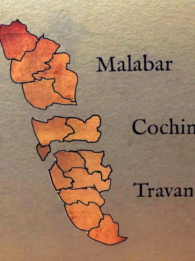
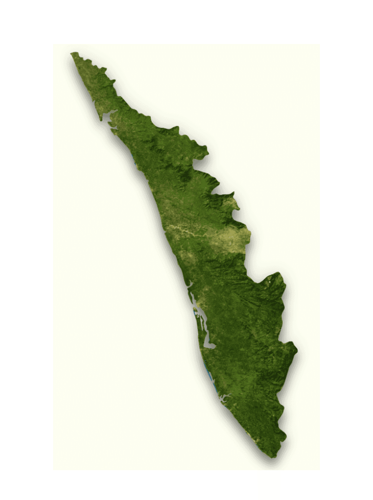
Kerala is a narrow, tropical state stretching along the south-western coast of India.
With the Arabian Sea to the west and the towering Western Ghats to the east, Kerala occupies a remarkable strip of land filled with beaches, backwaters, rivers, forests, wetlands, plantations and mountains.
Although relatively small in area, Kerala contains an extraordinary variety of landscapes.
Travel from the coast towards the mountains and the scenery can change dramatically within just a few hours—from coconut-lined beaches and peaceful canals to rubber plantations, dense forests, waterfalls, tea estates and mist-covered mountain peaks.
This geography has shaped almost every part of Kerala’s story: its food, agriculture, trade, wildlife, climate, economy and even the way communities developed.
To understand Kerala, it helps to first understand the land itself.

Kerala at a Glance

Country: India
Region: South India
Capital: Thiruvananthapuram
Largest urban centre: Kochi metropolitan area
Area: Approximately 38,863 square kilometres
Coastline: Approximately 590 kilometres along the Arabian Sea
Districts: 14
Highest Peak: Anamudi
Major Mountain Range: Western Ghats
Major Lake: Vembanad Lake
Official Language: Malayalam
Kerala shares borders with Karnataka to the north and north-east and Tamil Nadu to the east and south-east.
The Arabian Sea forms its long western boundary.
A Land Between Mountains and Sea
Perhaps the easiest way to understand Kerala’s geography is to imagine three broad natural regions running roughly parallel to one another.
The Highlands
The eastern part of Kerala rises into the Western Ghats.
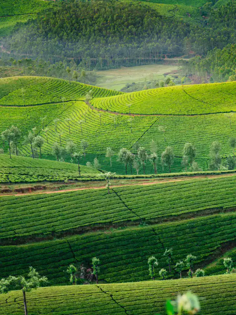
This mountainous region contains forests, wildlife sanctuaries, tea plantations, cardamom estates and some of the highest peaks in South India.
The Midlands
Between the mountains and the coast lies an undulating landscape of hills and valleys.
Rubber, coconut, pepper, banana, tapioca and numerous other crops grow throughout this fertile region.
Many of Kerala’s towns and villages are found here.
The Lowlands
Along the Arabian Sea lies Kerala’s coastal plain.
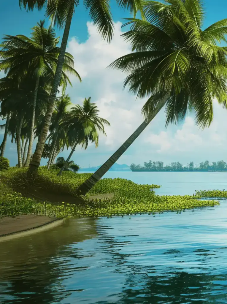
This is the land of beaches, estuaries, lagoons, canals, rice fields and the famous Kerala backwaters.
Together, these three landscapes give Kerala its extraordinary geographical diversity.
The Western Ghats
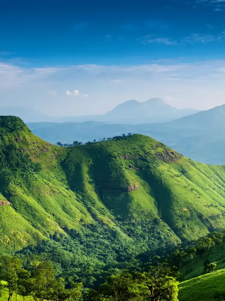
Rising dramatically along Kerala’s eastern boundary are the Western Ghats, one of the most important mountain systems in India.
Older than the Himalayas, these mountains stretch for approximately 1,600 kilometres along India’s western side and are recognised by UNESCO for their exceptional biodiversity.
Within Kerala, the Western Ghats create some of the state’s most spectacular landscapes.
Places such as Munnar, Wayanad, Thekkady, Vagamon and Ponmudi attract visitors with their mountains, forests, plantations and cooler temperatures.
The mountains also play an essential role in Kerala’s climate.
Moist winds travelling from the Arabian Sea encounter the Western Ghats and rise, producing the heavy monsoon rainfall that keeps much of Kerala green.
Anamudi – The Roof of Kerala
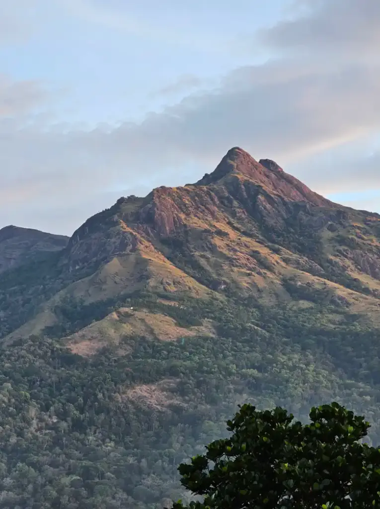
At approximately 2,695 metres above sea level, Anamudi is the highest peak in Kerala and the highest point in peninsular India.
Located within Eravikulam National Park near Munnar, its name is often translated as “elephant’s forehead,” referring to the shape of the mountain.
The surrounding landscape contains grasslands, forests and habitats for wildlife including the endangered Nilgiri tahr.
The region demonstrates just how different Kerala’s mountainous interior can be from its tropical coastline.
Kerala's Rivers

Kerala is crossed by an extraordinary network of rivers.
The state traditionally counts 44 rivers, most originating in the Western Ghats.
Because Kerala is relatively narrow, many of these rivers travel comparatively short distances before reaching the Arabian Sea or joining lakes and backwater systems.
Major rivers include:
- Periyar
- Bharathapuzha
- Pamba
- Chaliyar
- Chalakudy
- Kallada
- Achankovil
Among them, the Periyar is Kerala’s longest river entirely within the state and is enormously important for drinking water, agriculture, industry and electricity generation.
Rivers have influenced where communities developed and have supported agriculture and trade for centuries.
The Backwaters
Few geographical features are more closely associated with Kerala than its backwaters.
This remarkable network of lakes, lagoons, rivers and canals runs through much of the coastal region.
For generations, these waterways served as natural highways.
People travelled between villages by boat, while rice, coconuts, spices and other goods were transported through the canals.
Today, the backwaters are internationally famous for their houseboats and peaceful landscapes.
Alappuzha (Alleppey) and Kumarakom are among the best-known destinations for experiencing them.
But the backwaters are not simply tourist attractions.
They are living ecosystems and home to communities whose livelihoods remain connected to fishing, farming and the waterways.

Vembanad Lake
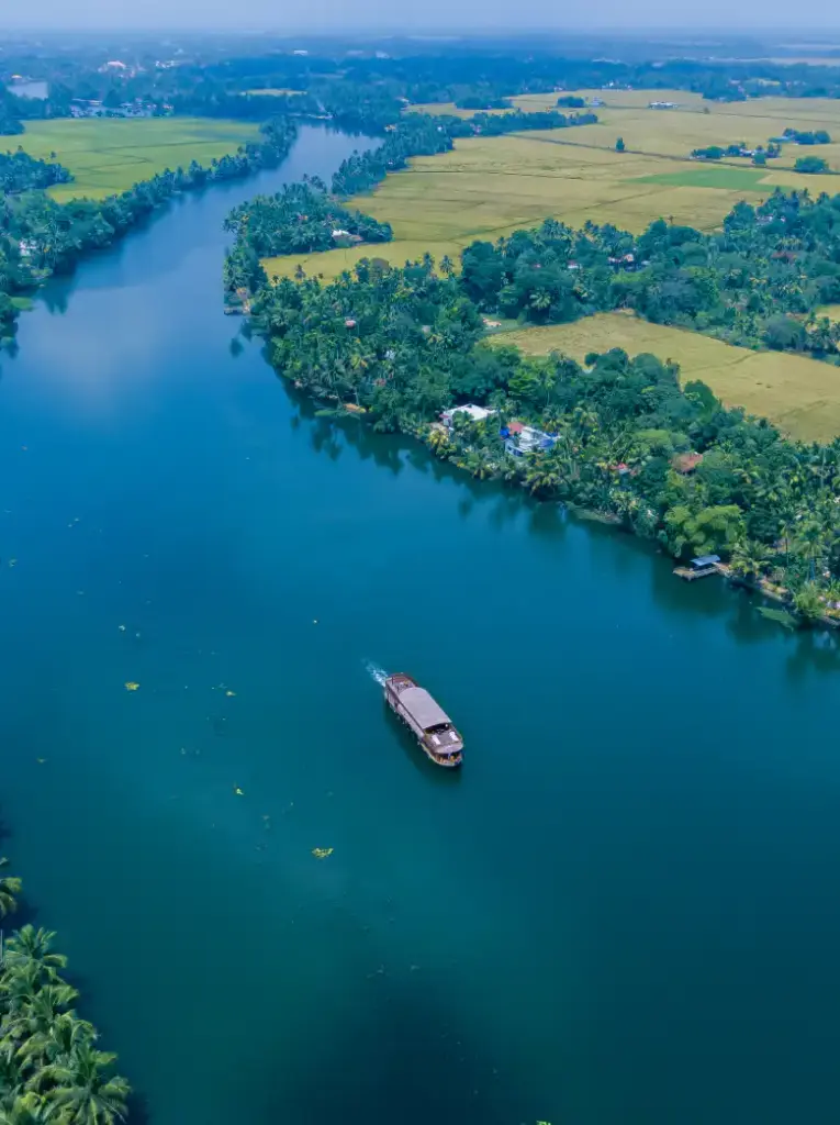
At the heart of Kerala’s backwater system lies Vembanad Lake, the longest lake in India and the largest lake in Kerala.
It stretches across several districts and plays an important role in fishing, transportation, agriculture and tourism.
The lake is also closely connected with Kerala’s famous snake boat races.
Near Kumarakom, its wetlands provide important habitats for birds and other wildlife.
Vembanad demonstrates the close relationship between Kerala’s people and water—a relationship that has shaped life here for centuries.
Kuttanad – Farming Below Sea Level
One of Kerala’s most fascinating geographical regions is Kuttanad, often called the “Rice Bowl of Kerala.”
Parts of this low-lying region are cultivated below sea level.
A remarkable system of bunds, canals and waterways allows farmers to cultivate rice in landscapes surrounded by water.
Travelling through Kuttanad reveals an unusual world of paddy fields, coconut palms, narrow canals and villages connected by bridges and boats.
It is one of the clearest examples of how Malayalees have adapted to Kerala’s distinctive geography.

Kerala's Coastline

Kerala has approximately 590 kilometres of coastline along the Arabian Sea.
Its coast includes sandy beaches, rocky shores, fishing villages, estuaries and busy ports.
Some of the best-known beaches include:
- Kovalam
- Varkala
- Marari
- Cherai
- Bekal
- Kappad
- Muzhappilangad
For centuries, Kerala’s position on the Arabian Sea connected it with the wider world.
Ships carrying spices sailed from its ports towards Arabia, Africa, China and Europe.
Kerala’s geography therefore didn’t isolate it.
It connected it.
The sea helped make Kerala an important meeting point for traders, religions, languages and cultures.
Forests and Rainforests
Travel east towards the Western Ghats and Kerala becomes increasingly forested.
These forests form part of one of the world’s great biodiversity regions.
Tropical evergreen forests, moist deciduous forests, montane grasslands and other ecosystems provide habitats for thousands of species.
Protected areas such as Periyar Tiger Reserve, Silent Valley National Park, Eravikulam National Park and Wayanad Wildlife Sanctuary help preserve these landscapes.
Kerala’s forests are also important sources of water.
Many of the state’s rivers begin in the forested mountains of the Western Ghats.
Protecting these landscapes therefore affects not only wildlife but millions of people living downstream.

Kerala and the Monsoon

Rain is fundamental to Kerala’s geography.
The state is strongly influenced by the south-west monsoon, which normally brings substantial rainfall from around June onwards.
The north-east monsoon, particularly later in the year, also contributes rainfall.
The arrival of the monsoon transforms the landscape.
Rivers fill, waterfalls become powerful, forests deepen in colour and fields turn intensely green.
For generations, the rhythm of agriculture and everyday life has been closely connected to these seasonal rains.
The monsoon is therefore more than weather.
It is part of Kerala’s identity.
Why Kerala Is So Green
Visitors often describe Kerala as extraordinarily green.
There is a geographical reason.
Warm tropical temperatures, substantial rainfall, numerous rivers and fertile soils support lush vegetation across much of the state.
Coconut palms dominate many coastal landscapes, while rubber plantations cover parts of the midlands.
Higher elevations support tea, coffee and cardamom plantations.
Pepper vines, banana plants, jackfruit trees and countless other tropical plants thrive across Kerala.
The result is a landscape where agriculture, forest and human settlement frequently exist side by side.
The Land of Spices
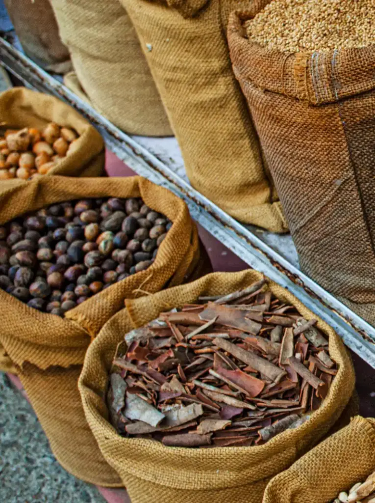
Kerala’s geography helped make it one of the world’s great spice-producing regions.
The humid climate and fertile slopes of the Western Ghats provide excellent conditions for crops such as:
- Black pepper
- Cardamom
- Ginger
- Turmeric
- Cloves
- Cinnamon
For thousands of years, these spices attracted traders from distant lands.
In this way, Kerala’s geography influenced not only its own history but also global exploration and commerce.
Mountains created the conditions for spices to flourish.
The sea created the route through which they travelled around the world.
Kerala's 14 Districts
Kerala is divided into 14 administrative districts, each with its own landscapes, traditions and attractions.
From north to south they are:
Kasaragod
Kannur
Wayanad
Kozhikode
Malappuram
Palakkad
Thrissur
Ernakulam
Idukki
Kottayam
Alappuzha
Pathanamthitta
Kollam
Thiruvananthapuram
One of the joys of exploring Kerala is discovering how much the landscape changes between them.
Wayanad and Idukki are known for mountains and forests.
Alappuzha and Kottayam are closely associated with backwaters and wetlands.
Ernakulam is more commercial with many thriving businesses and also has Cochin known as the Queen of Arabian Sea.
Thiruvananthapuram known as the cultural capital with beaches, hills and heritage.
The northern districts, meanwhile, reveal another side of Kerala through distinctive landscapes, cuisine, traditions and history.
Geography Shapes Kerala's Cuisine

Even Kerala’s food can be understood through geography.
Along the coast, fish and seafood naturally became central to many cuisines.
Coconut grows abundantly throughout the state and appears in countless dishes.
The mountains provided pepper, cardamom and other spices.
Rice flourished in fertile wetlands.
Trade brought additional ingredients and culinary influences from Arabia, Europe and elsewhere.
Kerala’s famous cuisine therefore developed not simply from recipes passed between generations but from the land and sea surrounding those generations.
Geography Shapes Kerala's Culture
Mountains, rivers and oceans have influenced much more than food.
They shaped settlement patterns, occupations, architecture, transportation and traditions.
Fishing communities developed along the coast.
Farming communities cultivated the fertile interior.
Plantations transformed parts of the highlands.
Ports became gateways to the wider world.
Backwater communities developed around boats and canals.
Kerala’s cultural diversity cannot be separated from its geographical diversity.

A Fragile Landscape
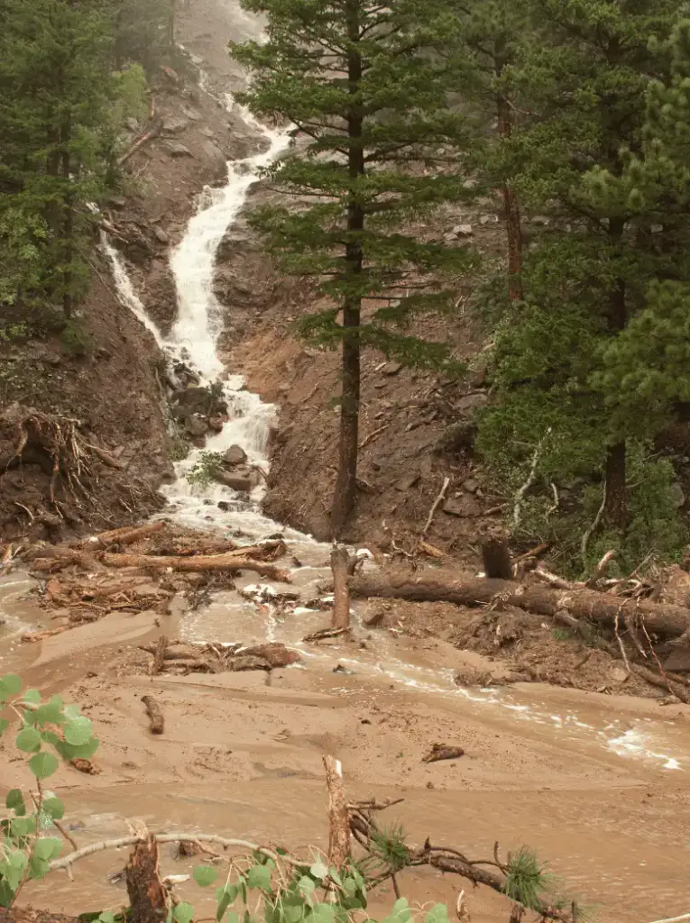
Kerala’s geography also creates challenges.
Heavy monsoon rainfall can cause flooding and landslides, particularly in vulnerable mountain regions and river basins.
Coastal erosion threatens some communities along the Arabian Sea.
Wetlands face pressure from development and pollution.
Climate change may intensify some of these challenges.
Kerala therefore faces an important question: how can a densely populated state continue developing while protecting the extraordinary landscapes on which its people, wildlife and economy depend?
Responsible tourism and environmental conservation will increasingly be part of the answer.
Why Kerala's Geography Is So Special?
Few places combine so many different landscapes within such a compact area.
In Kerala, you can wake beside the Arabian Sea, travel through coconut groves and rice fields, cross rivers and backwaters, and finish the day among mountains and tea plantations.
But Kerala’s geography is about much more than beautiful scenery.
The mountains gave Kerala water and spices.
The monsoon gave it abundance.
The rivers gave it fertile land.
The backwaters connected its communities.
And the Arabian Sea connected Kerala to the world.
Together, these forces created the landscape, economy, cuisine, culture and history of the Kerala we know today.
That is what makes the geography of Kerala truly fabulous.
Kerala Geography – Quick Facts

Location: South-west coast of India
Area: Approximately 38,863 km²
Coastline: Approximately 590 km
Districts: 14
Highest Point: Anamudi – approximately 2,695 metres
Major Mountain Range: Western Ghats
Number of Rivers: Traditionally counted as 44
Largest Lake: Vembanad Lake
Sea: Arabian Sea
Neighbouring States: Karnataka and Tamil Nadu
Major Natural Regions: Highlands, Midlands and Lowlands
Did You Know?
Kerala covers only a small fraction of India’s total land area, yet its location between the Western Ghats and Arabian Sea gives it an exceptional concentration of landscapes and ecosystems.
In the space of a relatively short journey, visitors can experience beaches, backwaters, wetlands, tropical forests, waterfalls, plantations and mountains.
It is one of the reasons Kerala can feel much larger—and far more varied—than a map might suggest.
